
Mount Arafat from Above: Satellite Images and Drone Views
Photos of Mount Arafat from a satellite at an altitude of 518 kilometers, as well as footage captured by drones. 🌴 @SaudiaUAE
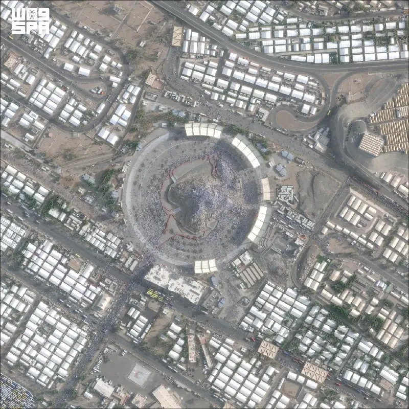
Impressive satellite photographs of Mount Arafat from an altitude of 518 kilometers reveal the scale of this sacred pilgrimage site in a new light, allowing us to see its geographical significance.
Arafat Through the Lens of Space Technology
Mount Arafat is one of the most important shrines in Islam, located in a valley about 22 kilometers east of Mecca. High-resolution satellite images taken from orbit at an altitude of 518 kilometers show the unique relief of the surrounding terrain and reveal the true scale of this sacred site. Thanks to modern space technologies, travelers and researchers can appreciate the geographical location of Arafat and its connection to neighboring areas of Saudi Arabia.
Drone Footage: A New Perspective on Pilgrimage
Footage captured by drones complements satellite images with detailed information about the mountain itself and the surrounding areas. Aerial photography allows us to see what Arafat looks like from a level unattainable for an ordinary tourist on the ground, yet much closer than the cosmic view. Such footage helps to better understand the architectural layout of the places where pilgrims perform rituals during Hajj and to appreciate the scale of the gathering of people during this holy period.
The Significance of Arafat in Islamic Pilgrimage
Mount Arafat occupies a central place in the Hajj ritual — standing at Arafat (wuquf) is one of the five pillars of pilgrimage. It is here, according to Islamic tradition, that the Prophet Muhammad delivered his farewell sermon. Every year, millions of believers gather on the slopes of this mountain for prayer and reflection. Visual materials from satellites and drones help those who have not yet made the pilgrimage to better imagine this place and prepare for the spiritual experience.
Technologies in the Service of Tourism and Education
Modern satellite systems and drones open up new opportunities for documenting historical and religious sites. Such visual materials become a valuable resource for tourism platforms, educational projects, and research in geography and anthropology. The high quality of images not only inspires potential travelers but also helps them plan their routes, understanding the real geography and infrastructure of pilgrimage areas.
Frequently Asked Questions
Why is Mount Arafat important for Muslims?
Mount Arafat is the place where the Prophet Muhammad delivered his farewell sermon. Standing at Arafat is one of the main rituals of Hajj, mandatory for all pilgrims. This place is considered one of the most sacred in Islam after the Kaaba and the Prophet's Mosque.
How do drones help study pilgrimage sites?
Drones allow for detailed aerial photographs of sites from a safe height, avoiding crowds and danger. Such footage helps tourists and researchers better understand the scale of the sites, architecture, and geographical context of pilgrimage centers.
What information do high-resolution satellite images provide?
Satellite images from an altitude of 518 kilometers show the topography of the terrain, the location of mountains and valleys, road infrastructure, and the layout of surrounding areas, which helps to better understand the geographical context of the shrine.