
Boundaries of the Haram of Makkah: Landmarks, Distances and Roads
A practical guide to the boundary of the Haram of Makkah: the white stone arches, the four key points at At-Tanim, Al-Ji’ranah, Hudaybiyyah and Idhat Libn, distances from the Kaaba, the difference from the miqat and how to reach the points.
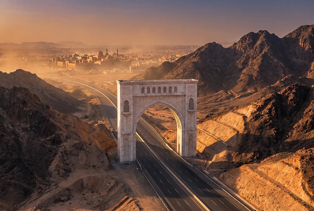
The Haram of Makkah is a protected zone around the Kaaba. Its boundary runs in a rough ring around the city, from about 6 to about 24 km from the Kaaba depending on the direction, and it is marked on the main roads by white stone arches with the inscription “BEGINNING OF HARAM”. Knowing where the boundary lies is useful when you plan trips around the city, drive to Jeddah, Taif or Madinah, or choose a hotel on the edge of Makkah.
A note on what this is. ZiyaraGo is an independent information service. We describe the geography and give practical advice; we do not give religious instructions. Rules are set by the Saudi authorities, and all distances in this guide are approximate: sources differ by a few kilometres.
What the boundary is and how it is marked
The boundary of the Haram is not one road but a line that follows the terrain and crosses the main routes at known points. On the highways it is marked by white stone arches. Inside the zone, special rules apply: hunting and cutting down trees are prohibited. The zone is much larger than the Grand Mosque itself and covers the whole urban area of Makkah and part of the surroundings.
Arafat is outside the boundary of the Haram, and so are the miqat points, which lie farther out on the approaches to the city. The rest of this guide goes around the boundary by the four directions.
North: At-Tanim and Masjid Aisha, about 6–8 km from the Kaaba
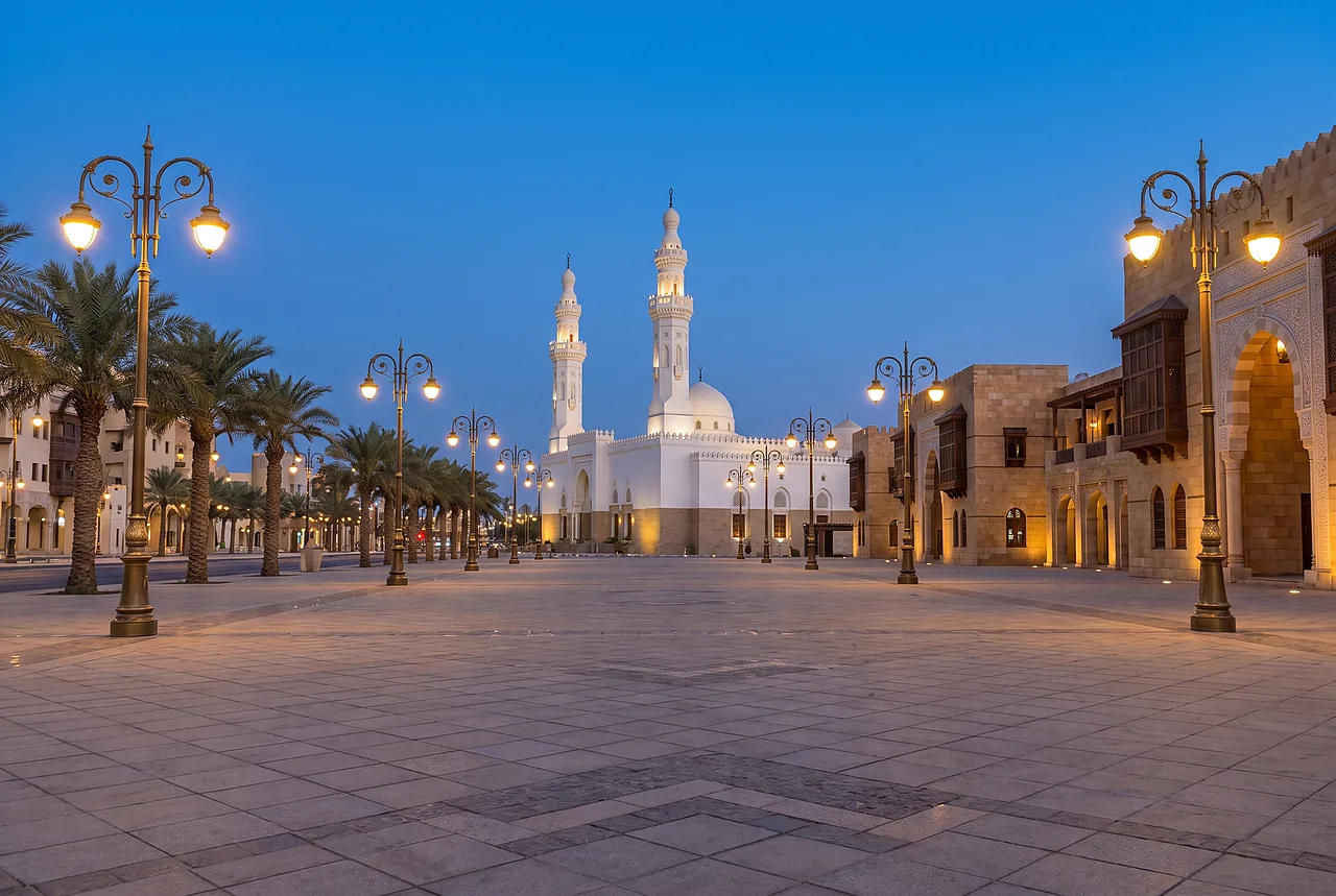
At-Tanim, in the north of Makkah, is the closest of the four key points to the city centre, about 6 to 8 km from the Kaaba. It is also the easiest to reach: it is a built-up area, and a taxi or the transport arranged by your hotel or tour operator will take you there in a short time.
The landmark of At-Tanim is Masjid Aisha, a large mosque that is recognised by visitors as the boundary point. The area around it has services and is busy, especially in the evening and in the seasons of Umrah and Hajj.
East: Al-Ji’ranah, about 14–16 km
Al-Ji’ranah is the boundary point to the east, about 14 to 16 km from the Kaaba. It is farther than At-Tanim and has fewer services, so check the route and the time with the trip organiser before you go.
If you use a taxi, agree the price and the waiting time in advance, and keep in mind that the way back in the evening can take longer than the way out.
West: Hudaybiyyah, about 24 km
Hudaybiyyah is on the western side, about 24 km from the Kaaba. It is known in history as the place where the Treaty of Hudaybiyyah was concluded.
Plan the visit as a separate trip: the distance is the largest of the four, so allow enough time for the road in both directions.
South: Idhat Libn, about 11–12 km
Idhat Libn marks the southern edge of the boundary, about 11 to 12 km from the Kaaba. Information about this point is limited, so it is best reached with a driver or a guide who knows the exact place.
Distances to this point differ between sources; treat the figure as a guide and confirm the route when you book the transport.
The Haram boundary and the miqat are not the same thing
The boundary runs 6 to 24 km from the Kaaba. The miqat points are farther out, from about 80 to 190 km from Makkah depending on the direction of travel. For the location of each one, see our guide to the five miqats.
Practical advice for planning around the boundary

Choose your hotel with the boundary in mind. Hotels in the centre, such as those around Ajyad, are well inside it, while districts at the edge of the city are closer to the boundary points and to the highways. Our guide to where to stay in Makkah compares the districts, and the history of the street next to the mosque is in the article on Ajyad.
How we chose
We built this guide from the distances in our own place catalogue and public sources, and we left out the details on which sources disagree. It is information for planning and does not replace the instructions of the authorities, your operator or the official apps.
Tips
- Treat all distances as approximate and confirm the route with the organiser before you travel.
- At-Tanim is the easiest point to reach; the others are farther and need a longer trip.
- Agree the price and the waiting time with the driver in advance.
- Check the current announcements of the Ministry of Hajj and Umrah before the Hajj season.
Questions and answers
How far is the boundary of the Haram from the Kaaba?
Roughly 6 to 24 km depending on the direction: At-Tanim 6–8 km, Idhat Libn 11–12 km, Al-Ji’ranah 14–16 km and Hudaybiyyah 24 km.
What marks the boundary?
White stone arches on the main roads with the inscription “BEGINNING OF HARAM”.
Is Arafat inside the Haram?
No, Arafat lies outside the boundary of the Haram.
What is prohibited inside the Haram?
Hunting and cutting down trees.
Is the boundary of the Haram the same as the miqat?
No. The miqat points are farther out, about 80 to 190 km from Makkah, and Dhul Hulayfah on the road from Madinah is farther still.
Prepared with the help of AI and checked by the ZiyaraGo team. Editorial policy